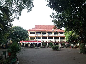
Duren Sawit
Duren Sawit is a district (kecamatan) of East Jakarta, Indonesia. The rough boundaries of Duren Sawit are I Gusti Ngurah Rai road to the north, Kali Sunter to the west, and Kali Malang to the south. The district borders the districts of Jatinegara to the west, Cakung and Pulo Gadung to the north, and Makasar to the south, and Bekasi to the east.
Read article
Top Questions
AI generatedMore questions
Nearby Places
East Jakarta
Administrative city in Jakarta, Indonesia

Klender railway station
Railway station in Indonesia

State Elementary School Cipinang Melayu 12 Petang
Public school in Jakarta, Indonesia

State Elementary School Pondok Kelapa 07 Pagi
Public school in Jakarta, Indonesia

State Elementary School Pondok Kelapa 09 Pagi
Public school in Jakarta, Indonesia

Buaran railway station
Railway station in Indonesia

Jatikramat River
River in Jakarta, Indonesia
Jati Bening Baru LRT Station
LRT station in Indonesia
